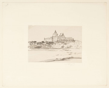
Lublin Castle
1918 — 1919
National Museum in Lublin
Part of the collection: Lubliniana. Painting views of Lublin and the Lublin Region (17th–early 20th c.)
An oldest and most valuable view of Lublin is the panorama of the city depicted in Civitates orbis terrarium, Georg Braun’s 6-volume world atlas that had been compiled over the course of more than 45 years and published in Cologne in the years 1572-1618. The last volume of the work, entitled Theatri praecipuarum totius mundi urbium liber sextus, presents 17 views of Polish cities.
The view of Lublin, engraved by Abraham Hogenberg according to a drawing by an unknown author (probably from the Jesuit circle), shows the city in its most splendid development, before the Deluge. The take of the city is from the south, it is surrounded by pools of water in the foreground and hills in the background. It shows the city and the castle within the walls as well as the surrounding villages, suburbs and the settlement of Piaski, later incorporated into the boundaries of the ‘goat’ hillfort. The copperplate engraving shows the buildings characteristic of Lublin, towering over residential buildings. The central place is occupied by the Jesuit Church – today the Metropolitan Cathedral. Behind it, the Old Town hill enclosed from the west by the Kraków Gate, crowned with a tower, and from the east by the Grodzka Gate. To the right of the Jesuit Church is the parish church of St. Michael (does not exist anymore) and the Dominicans. On the neighbouring hill is a complex of castle buildings with a high keep from the 13th century, and next to it the Gothic Church of the Holy Trinity and residential buildings altered in the Renaissance period and crowned with a high attic. At the foot of the Castle are craftsmen’s buildings. All around the hill there are waters of the dammed-up rivers Bystrzyca and Czechówka as well as the so-called Great Royal Pond. On the left, outside of the city walls, are silhouettes of, among others, the following churches: Virgin Mary (former Bridgettines), Conversion of St. Paul (former Bernardines) and the Holy Spirit. The view is completed by a large, decorative cartouche with the inscription: TIPUS CIVITATIS LUBLINE [N] SIS. / IN REGNO POLONIAE EX OMNIBUS / PARTIBUS MU [N] DI EMPORIO. TER. IN / ANNO CELEBRARI CONSUETOCLARAE and by its sides there are cartouches with the coats of arms of Poland and Lublin. The legend describes 22 buildings and places, and an additional 6 objects are marked in the figure.
The inclusion of the view of Lublin in one of the largest and most important works in the field of urban topography in the world proves the importance of the city on the Bystrzyca in the 16th and early 17th centuries. The prints of this engraving, in black and white or hand-coloured with watercolour, were extremely popular and were frequently reissued and reprinted.
Renata Bartnik
Author / creator
Dimensions
cały obiekt: height: 49,5 cm, width: 30,9 cm
Object type
graphics
Technique
coloured copper engraving
Material
paper, aquarel
Creation time / dating
Creation / finding place
Owner
The National Museum in Lublin
Identification number
Location / status