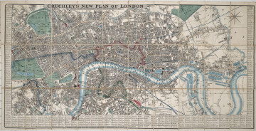
New Plan of London
1845
Castle Museum in Łańcut
Part of the collection: Cartography
The object we see presents a road map of the Margraviate of Moravia within the borders of the Austro-Hungarian monarchy. In 1867, the Austrian Empire became the dualistic monarchy of Austria-Hungary. The state was divided into a part called Cisleithania – including Austria, Tyrol, Croatia, Bohemia, Moravia, Teschen Silesia, Galicia and Bukovina, as well as Transleithania – the lands of the Kingdom of Hungary. The presented map concerns the area lying within Cisleithania. The Margraviate of Moravia was a crown land within the Austrian and later Austro-Hungarian Empire from 1849 to 1918. Its capital was the city of Brno, where the National Assembly met, deliberating in German and Czech. It was bordered by Bohemia, Galicia, Hungary, as well as Prussia – later Germany. The map was published by Artaria & Compagnie in Vienna. The company was founded in 1770 by Carlo Artaria as a published or artworks and maps. Starting in 1779, it expanded its repertoire to include music, through, among others, collaboration with composer Joseph Haydn. The publishing house began to decline in the 20th century, until it was finally closed in 1932. The collection of the Łańcut Museum includes maps which are souvenirs from the numerous travels of the Counts Potocki. This is one of those maps. The map is foldable and can be stored in its original cardboard case. Łukasz Chrobak
Author / creator
Dimensions
height: 30 cm, width: 30 cm
Object type
Cartography
Technique
Material
paper, cardboard
Creation time / dating
Creation / finding place
Owner
Castle Museum in Łańcut
Identification number
Location / status

1845
Castle Museum in Łańcut

1855
Castle Museum in Łańcut

1877
Castle Museum in Łańcut
DISCOVER this TOPIC
National Museum in Szczecin
DISCOVER this PATH
Educational path