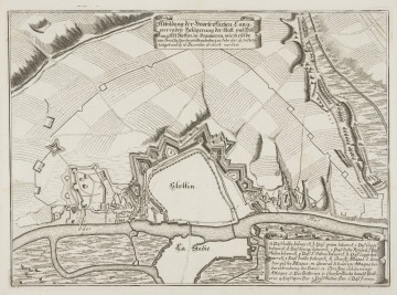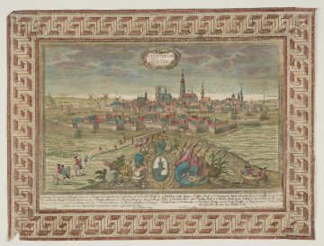
View of siege of Szczecin in 1677
1677 — 1682
National Museum in Szczecin
Part of the collection: Historic cartography
The 18th century was a period of major political, economic, and territorial change for Szczecin. The city, officially taken over by Prussia in 1720, began to transform into a powerful fortress. Meanwhile, there was a growing demand for maps of the Szczecin agglomeration and the areas of Pomerania, often to be included in larger chronicles or atlases. A copperplate engraving by Johann Wilhelm Michaelis (1677-1736), published around 1720, is linked to the commemoration of the takeover of Pomerania by Prussia. As its name proclaims, it depicts a detailed map of the Duchy of Pomerania with views of eight towns in a decorative bordure. It was intended as a chronicle tracing mainly the history of the Pomeranian church, compiled over the years up until his death by Günther Heiler (1645-1707), a Lutheran theologian who held the post of superintendent of Farther Pomerania and the Duchy of Cammin, which belonged to the Kingdom of Prussia, from 1688. Twenty-two illustrations and a map for this publication were produced by Michaelis, a German engraver who arrived in Stargard in 1707, where he worked and lived until his death, and whose remains are buried in Stargard's Church of the Holy Spirit. The map he produced was the only cartographic work produced in Pomerania to be published by Heiler. Although the manuscript was a complete work, the three-volume chronicle of Pomerania was never printed, and Michaelis' map was published years later as an independent work. Eighteenth-century engravers often built on earlier cartographic works when creating maps. As a model for his map of Pomerania, Michaelis adopted the map drawn by the famous German cartographer, mathematician, and theologian Eilhardt Lubinus, while the views of the eight towns were modelled on the illustrations of the famous Swiss engraver Matthäus Merian. However, the work of the Stargard engraver also bears the hallmarks of his individual work. It is illustrated with images of St. Otto and Jan Bugenhagen, German clergymen involved in the history of the Pomeranian Church, as well as an allegory of cartography above the divisions of the map's scale, depicting a putto holding a surveyor's wheel and a compass lying next to it, surrounded by ears of grain and bees buzzing above straw hives. Małgorzata Peszko
Author / creator
Object type
map, graphic
Technique
copper engraving
Material
paper
Origin / acquisition method
legal transfer
Creation time / dating
Creation / finding place
Owner
Muzeum Narodowe w Szczecinie
Identification number
Location / status

1677 — 1682
National Museum in Szczecin

1735
National Museum in Szczecin

1623
National Museum in Szczecin
DISCOVER this TOPIC
National Museum in Lublin
DISCOVER this PATH
Educational path