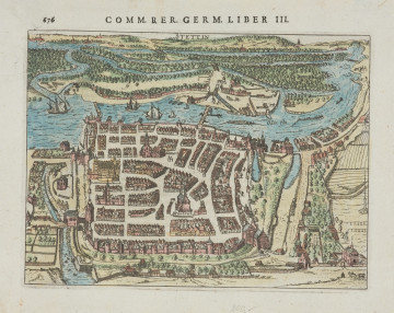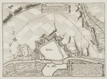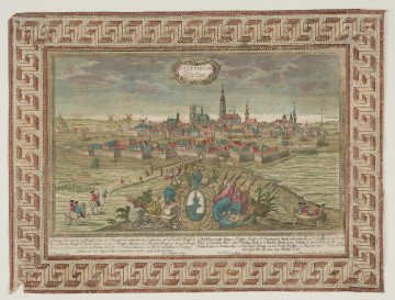
Bird's eye view of Szczecin
1632
National Museum in Szczecin
Part of the collection: Iconography of Szczecin in the 17th-19th centuries
Views of Szczecin from the first half of the 18th century were far from faithful to the actual topography. Decorated and coloured, they were of artistic value and their authors were cartographers and engravers at the same time. In their works, they usually modelled their views on representations of the city created in an earlier period, making slight, updating changes. This type of views was used as illustrations in increasingly popular national, geographic and historical works about European and world powers, commissioned by rulers of individual countries. For many years their publishers created several-volume atlases illustrated with city views, which they considered interesting and worth including in publications. An example of such a publication is Force d'Europe, from 1720-1740, describing and illustrating the most famous cities of Europe, especially due to their modern fortifications, forts, sea ports, passes and military camps. It includes a copperplate engraving with a plan of Szczecin created around 1725, whose author, and the publisher, was Gabriel Bodenehr the Elder (1664-1758 or 1673-1765). The German cartographer and engraver, who came from a well-known Augsburg family of publishers and engravers, mainly created views of cities in Prussia. The copperplate with a plan of Szczecin shows the city with Swedish fortifications. It also contains columns with text informing about the location of the city, its rivers, bridges, churches, castle and ducal pedagogy. It also concerns the history of the Pomeranian capital from 1630 to 1720, i.e. from the decline of the Griffin dynasty, through the period of Swedish rule, to the takeover of Szczecin by Prussia. Moreover, at the bottom of the right-hand side, there is a legend explaining the functions of the buildings marked on the plan and the names of the main squares. The coat of arms with the head of a griffin and a small wind rose placed on the sheet are decorative.
Małgorzata Peszko
Author / creator
Dimensions
cały obiekt: height: 19,2 cm, width: 32,8 cm
Object type
chalcography (print)
Creation time / dating
Creation / finding place
Identification number
Location / status

1632
National Museum in Szczecin

1677 — 1682
National Museum in Szczecin

1735
National Museum in Szczecin
DISCOVER this TOPIC
Museum of King Jan III's Palace at Wilanów
DISCOVER this PATH
Educational path