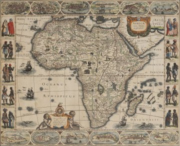
Africae Nova Tabula | New map of Africa
1623
National Museum in Szczecin
Part of the collection: Iconography of Szczecin in the 17th-19th centuries
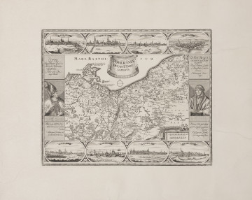
Johann Baptist Homann (1664-1724) was one of the most highly regarded 18th-century German cartographers, engravers, and publishers of maps and globes. In 1702 he established a large map engraving workshop in Nuremberg, which ushered in the era of surveying cartography. After establishing his own cartographic publishing house, Homann focused primarily on the production of beautiful, yet cheap maps, which he could sell in huge numbers – with little regard to their correctness. He adorned his works with exceptionally attractive cartouches, boards and decorative details, full of heraldic, allegoric and emblematic content, based on obsolete Dutch patterns. One of such maps is the Tabula Marchionatus Brandenburgii et Ducatus pomeraniae quae sunt Pars Septentrionalis circuli Saxoniae Superioris novissime, which shows the Margraviate of Brandenburg and the Duchy of Pomerania. While fitting perfectly on the sheet, the map presented the division of Pomerania between Sweden and Brandenburg after the Peace of Westphalia in 1648 and did not take into account the territorial changes based on the Peace of Stockholm in 1720, which ended the Northern War.
Anna Lew-Machniak
Author / creator
Dimensions
cały obiekt: height: 53,7 cm
Object type
graphic
Creation time / dating
Creation / finding place
Identification number
Location / status

1623
National Museum in Szczecin

1720 — 1736
National Museum in Szczecin

1907
National Museum in Lublin
DISCOVER this TOPIC
Castle Museum in Łańcut
DISCOVER this PATH
Educational path