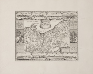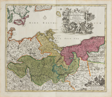
Pomeraniae Ducatuū Tabula Exacta | An accurate map of the Pomeranian Duchy
1720 — 1736
National Museum in Szczecin
Part of the collection: Historic cartography
The composition depicts a map of Africa surrounded by the waters of the Mediterranean Sea, the Atlantic and Indian oceans, including the islands close to the shores of the African continent and part of the Arabian Peninsula, with a grid of meridians and parallels marked every 10°. Mountain ranges and hills, the network of rivers including major lakes and the settlements, particularly dense along the coasts, have been marked on the lands. Silhouettes of exotic animals have also been insterted on the map where they figure geographically. Shoals were mapped in aquatic areas, and sailing ships, flying fish, and sea monsters were also portrayed. The Latin description of the map includes names of lands, countries, water facilities, localities, and islands. The map is enclosed by a frame with a scale every 1° and a bordering composed of city and island views, as well as representatives of African countries and ethnic groups in regional costumes. The author of the map, published in Amsterdam in 1623 by Joannes Janssonius (1588-1664), was Jodocus Hondius the elder (1563-1612), or rather Joost de Hondt, a copperplate engraver and cartographer, who first produced globes, and later became a co-founder of the Amsterdam school of cartography. From 1584 to 1593 he worked in London, documenting the lands discovered by Francis Drake during his voyage around the world. On his return to Amsterdam, he purchased Gerard Mercator's copperplate engravings and, after introducing some adjustments, re-printed them with great success, thus building up the cartographic Mercator/Hondius brand. The fact that Joannes Janssonius, a cartographer and publisher active in Amsterdam in the early 17th century, published the Hondius map was not a coincidence. In 1612 he married Elisabeth de Hondt (15..-1627), daughter of Jodocus. In the 1730s, he joined forces with his brother-in-law Hendricus Hondius to publish atlases under the trademark Mercator/Hondius/Janssonius. He had numerous bookshops abroad, in Frankfurt am Main, Gdańsk, Stockholm, Copenhagen, and Lyon. He published the Atlas Novus, then the Atlas Major comprising 11 volumes with works by about 100 authors and engravers including maps of land, water, sky, and city views in multiple language versions, such as Dutch, Latin, French, German, and partially English. Ewa Gwiazdowska
Author / creator
Object type
graphic, map
Technique
copper engraving, akwarela
Material
ribbed laid paper
Origin / acquisition method
purchase
Creation time / dating
Creation / finding place
Owner
Muzeum Narodowe w Szczecinie
Identification number
Location / status

1720 — 1736
National Museum in Szczecin

1907
National Museum in Lublin

1716 — 1729
National Museum in Szczecin
DISCOVER this TOPIC
National Museum in Lublin
DISCOVER this PATH
Educational path