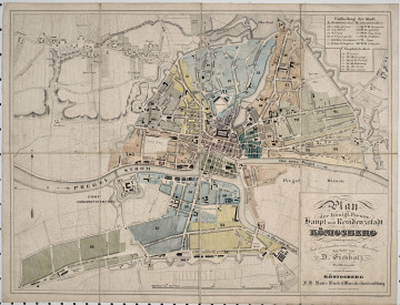
Plan der königl. Preuss. Haupt und Residenzstadt Königsberg
19th / 20th century
Castle Museum in Łańcut
Part of the collection: Cartography
R. Zannoni, Carte de Pologne, General View of Poland and Lithuania, 1772 After a period of dynamic development until the reign of Władysław IV Vasa, Polish cartography experienced a great stagnation, from mid-17th century, basically until the end of the Republic at the end of the 18th century. Wars with the Cossacks, Russia, Sweden and Turkey caused a great lull in the development of, among others, cartography. The lack of reliable maps was felt during Jan III Sobieski’s expedition to bring relief to Vienna. Another reason for the lack of good cartography was the Counter-Reformation, during which the Polish Brethren were exiled from the country. There were many cartography experts among the exiles. The revival of Polish cartography came in the second half of the 17th century. The Republic of Poland was home to cartographers of European renown, such as Franciszek Florian Czaki, Józef Aleksander Jabłonowski, Karol de Perthées and Giovanni Antonio Rizzi Zannoni, who is the author of the maps here. Zannoni placed a map of the Republic of Poland, Warsaw, Courland, and maps of individual Polish lands on 24 plates. The second sheet presents a general plan of Warsaw and its part on the second side of the Vistula, namely Praga. On the map edges are drawings of the most important aristocratic palaces in the city, including the Brühl Palace, the Branicki Palace, and the famous Saxon Palace. Aleje Ujazdowskie and Aleje Jerozolimskie, already famous at the time, as well as Krakowskie Przedmieście are marked. The maps have their own extensive legend. The author of the maps marked and distinguished, among others, the fortified city, fortresses, post offices, inns, manor farms, villages, saltworks and ironworks. Interestingly, the symbol of the crossed sabres marked the sites of historical battles. Of course, the author did not overlook rivers and forests, which speaks to progress and the use of modern trends in European cartography. All of these maps are foldable and can be stored in the original cardboard case. The ex libris of the Library of the Potockis of Łańcut can be found on the back of all the maps. Łukasz Chrobak
Author / creator
Object type
Cartography
Technique
flat print
Material
paper, cardboard
Creation time / dating
Creation / finding place
Owner
Castle Museum in Łańcut
Identification number
Location / status

19th / 20th century
Castle Museum in Łańcut

1788
National Museum in Szczecin

19th (?) century
Castle Museum in Łańcut
DISCOVER this TOPIC
Castle Museum in Łańcut
DISCOVER this PATH
Educational path