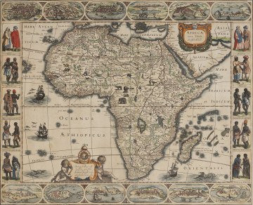
Africae Nova Tabula | New map of Africa
1623
National Museum in Szczecin
Part of the collection: Iconography of Szczecin in the 17th-19th centuries
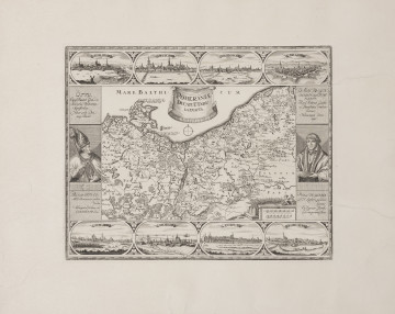
Johann Baptist Homann (1664-1724) was one of the greatest 18th century copper engravers and map publishers in Germany. In 1702, he established his own publishing house in Nuremberg, hoping to win the market dominated at that time by French and Dutch companies by offering favourable prices. His works were based on the principle that maps should be first of all beautiful, which came at the expense of their factual correctness. His maps were richly decorated with attractive cartouches, boards and decorative details, full of heraldic, allegoric and emblematic content, which constituted works of graphic art of sorts. One of the examples of such a map is his Ducatus Pomeraniae novissima Tabula in anteriorem et interiorem divisa, quatenus subsunt Coronis Sueciae et Borussiae cum insertis et adjacentibus Ditionibus, first published ca. 1717. The title suggested that it would be the latest version of the map of the Duchy of Pomerania, but in fact it was completely outdated – it presented the borders as they were in 1648, established by the Peace of Westphalia which ended the Thirty Years' War. The map of Pomerania by Johann Baptist Homann was published without any changes for the next several dozen years. The only addition was a note in the cartouche about the imperial privilege of 1734.
Anna Lew-Machniak
Author / creator
Dimensions
cały obiekt: height: 48,8 cm, width: 56,9 cm
Object type
graphic
Creation time / dating
Creation / finding place
Identification number
Location / status

1623
National Museum in Szczecin

1720 — 1736
National Museum in Szczecin

1907
National Museum in Lublin
DISCOVER this TOPIC
Museum of King Jan III's Palace at Wilanów
DISCOVER this PATH
Educational path