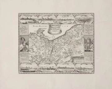
Poloniae Regnum ut et Magni Ducatus Lithuaniae
National Museum in Lublin
Part of the collection: Maps of Lublin and the Lublin Region and real estate plans (late 19th c.–the 1930s)
In 1907, a beautifully published atlas of the Kingdom of Poland was published in Warsaw. It had a spectacular cover made of red canvas with gilded ornamentation and colourful pages with illustrations and descriptions. The author was Józef Michał Bazewicz, a very imaginative and hard-working man. At first, he worked as a bookseller, then as a publisher specialising in maps and atlases, which he himself prepared.
The atlas contains a map of a given county, around which colourful illustrations have been placed. The author has shown on them the greatest cultural and natural wealth. Most often these are: historical monuments, folk costumes, shepherd scenes, natural treasures, qualities of the landscape. This richly illustrated atlas is not only a documentation of the diversity of the Polish lands. By depicting the culture of a nation that had been partitioned for many years, it was intended to arouse Poles' pride and build their identity. As the author writes, the aim of the publication was to acquaint the reader with his own country and its monuments, with the traces of past glory. He wanted the atlas to be in every Polish home and serve all compatriots, so that Poles would know not only their nearest neighbourhood, but the whole beautiful country and not be jealous of their neighbours' beautiful mountains or lakes, because the Polish land is rich in nature and culture.
The atlas is a testimony to Bazewicz's love of his homeland and its keepsakes, as well as to his patriotic attitude and concern for the education of Polish society.
Author / creator
Dimensions
cały obiekt: height: 23 cm, width: 29,7 cm
Object type
map
Technique
Material
paper
Creation time / dating
Creation / finding place
Owner
The National Museum in Lublin
Identification number
Location / status

National Museum in Lublin

Hondius, Jodocus
1623
National Museum in Szczecin

Michaelis, Johann Wilhelm
1720 — 1736
National Museum in Szczecin
DISCOVER this TOPIC
National Museum in Lublin
DISCOVER this PATH
Educational path
0/500

We use cookies to make it easier for you to use our website and for statistical purposes. You can manage cookies by changing the settings of your web browser. More information in the Privacy Policy.
We use cookies to make it easier for you to use our website and for statistical purposes. You can manage cookies by changing the settings of your web browser. More information in the Privacy Policy.
Manage cookies:
This type of cookies is necessary for the website to function. You can change your browser settings to block them, but then the website will not work properly.
WYMAGANE
They are used to measure user engagement and generate statistics about the website to better understand how it is used. If you block this type of cookies, we will not be able to collect information about the use of the website and we will not be able to monitor its performance.